Though my life has been shaped by the sea (sailing/freediving) I have as I grown older become more and more lured by mountains. Thinking of it: the siluette of a "highest point" has always been provoking. As a boy seeing a big stone, naturally I had to get up there. I guess its human instinct. Why? "Because it is there". No that is a silly response devoid of selfknowledge. In my case it may be as simple as:" I wonder what the view would be from up there".
So when passing Scotland in 2006 my boat I set my gaze upon the "hills". The highest mountain around turned out to be Ben Nevis (1200 meters), and to make it slightly more interesting me and a collegue in adventure (Annelie Pompe) approached without map or guidebook from the north side (see swedish TV report). Lots of fun.
I was drawn into Annelies dreams of Himalaya and next year we flew to Nepal to trek and climb the highest mountain we could afford (Imja Tse 6200meters). Also this resultet in a TV feature. We found Nepal a very nice country. Sagarmata national park was a cool place (hanging out with: Chomolungma, Lothse, Cho Oyo, Thamserku, Ama Dablam). I was fascinated by Himalaya and decided to be back within three years. And to motivate myself I wrote publicly here that I would be back in 2011. Meanwhile Annelie progressed into a real mountainclimber and invited me to be filmer on her Mount Everest expedition in may 2011.
As can be read in Annelie Pompes Blogg she does not like the Khumbu Ice fall and has choosen to join an expedition approaching Chomolungma from the north through Tibet.
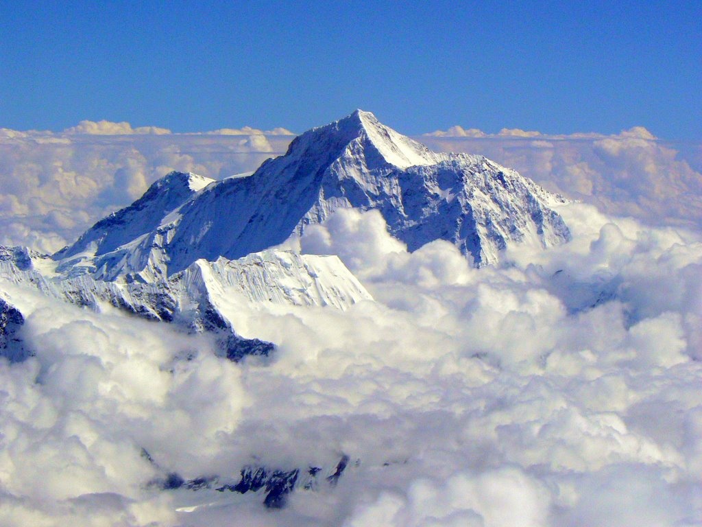
Chomolungma is 8848 meters high. The first 1400 meters are easy - you take an airplane to the Nepal Capital Kathmandu. If you are aiming to start climbing from south base camp you fly to Lukla at altitude 2800 meters and then trek to south base camp at 5500. This trek is hard on the body, walking upwards in increasingly less oxygen is felt, and will sometimes result in altitude sickness. The trick is to slow down and acklimatize to altitude slower.
If you are heading for the north base camp in Tibet the first 5200 meters are easy, you take a vehicle from Katmandu, to Lhasa, to the base camp. But not too fast - the body has to acklimatize.
So climbing Chomolungma is about the last 3600 meters.
From North side
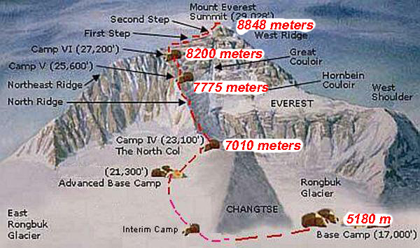
Base camp: 5180 meters, on a gravel plain just below the glacier.
-> ascend the medial moraineglacier up to the base of Changtse at around 6,100 m (20,000 ft). Camp III (ABC – Advanced Base Camp): 6500 meters.

Advanced base camp: 6500 meters
-> ascend the glacier to the foot of the col where fixed ropes are used to reach the North Col
North Col: 7000 meters (here is where my permit ends and Annelie and Sherpas continue)
-> ascend the rocky north ridge to set up Camp
Camp 1 (V): 7775 meters
-> The route crosses the North Face in a diagonal climb to the base of the Yellow Band reaching the site of Camp VI
Camp 2 (VI): 8230 meters
Camp 3 (VII):
-> a treacherous traverse from the base of the First Step: 27,890 feet (8,500 m)
-> to the crux of the climb, the Second Step: 28,140 feet (8,580 m)
-> (The Second Step includes a climbing aid called the "Chinese ladder", a metal ladder placed semi-permanently in 1975 by a party of Chinese climbers).
->Third Step is clambered over: 28,510 feet (8,690 m -> 8,800 m).
-> the summit pyramid is climbed by a snow slope of 50 degrees, to the final summit ridge along which the top is reached.
Summit: 8848 meters


